Giving google maps more responsibility.
/an introduction
How it
started
In a country as dynamic and chaotic as India, roads are not merely a network—they are a lifeline for millions. Yet, in the daily hustle, the blaring sirens of ambulances, police cars, and fire engines often go unheard, their urgency lost in the cacophony of honks and engines.
Imagine being in a situation where a loved one's life depends on those extra seconds an ambulance could save. This project aims to bridge this critical gap in awareness by introducing an Emergency Vehicle Alert System integrated with CarPlay and Android Auto. This system ensures that drivers are not only aware of approaching emergency vehicles but can act promptly to clear the way.
This case study captures the process, challenges, and insights gathered during the redesign. It is a story of turning user frustrations into opportunities for innovation and empathy-driven design.

/the problem
The metro
commuter’s maze
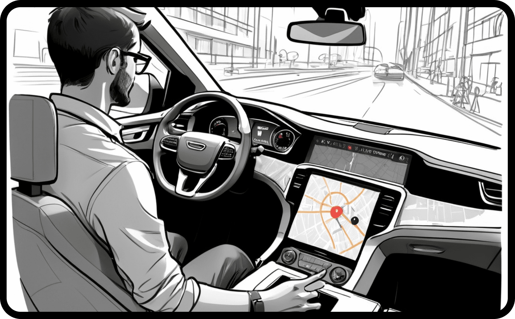
This project introduces an Emergency Vehicle Alert System integrated with Google Maps on Android Auto and CarPlay, designed to inform nearby drivers in real-time when an ambulance, fire truck, or police vehicle is approaching. The goal: create awareness, encourage compliance, and enable faster emergency response.
A study conducted by the Indian Council of Medical Research (ICMR) revealed that 25% of accident fatalities could be avoided with faster emergency response times. Delayed access to healthcare, especially in rural and congested urban areas, was cited as a critical factor.
The existing app presents several challenges
Emergency Response Time in India
Studies show that delayed emergency response on Indian roads can increase fatality rates by up to 50%. Traffic congestion and unawareness are prime culprits.
Driver Behavior
Research indicates that only 20% of Indian drivers consistently yield to emergency vehicles. The lack of clear communication and accountability exacerbates this issue.
Economic Cost
Poor emergency response can cost lives and result in economic losses exceeding ₹20,000 crores annually.
Current systems, like Waze’s ambulance alerts in the UK, demonstrate the potential of technology to improve response times. However, these systems are limited in scope and unavailable in India, where they are arguably most needed.
/the Design
Designing for
a change
Google Maps is already the go-to navigation app in India. Leveraging it minimizes onboarding friction and capitalizes on users' spatial familiarity. Its real-time traffic data and extensive coverage make it the ideal platform for deploying geofenced emergency notifications.
What I am aiming for
User-Centric Solutions
Prioritize user needs and gather feedback for continuous improvement.
Comprehensive Travel Information
Provide tools for trip planning, real-time information on crowding, alternate route suggestions, and easy access to metro stations.
Engagement and Information
Keep users informed with relevant news and notifications. Enable easy reporting of issues and provide quick responses in emergencies.
Accessibility and Convenience
Ensure accessibility for all users. Use clear navigation (e.g., color-coded lines), provide solutions for reaching the metro, and integrate with parking options.
Background story
Through our research, we discovered that the majority of our users are daily commuters who are well-acquainted with the routes and fares. Their primary pain point lies in the ticket collection process. To address this issue, I have developed a QR code generator linked to a virtual smart card. Users can recharge this smart card when their balance is low. When a user scans the QR code at a gate, a minimum amount is reserved, and the fare is deducted upon reaching their destination
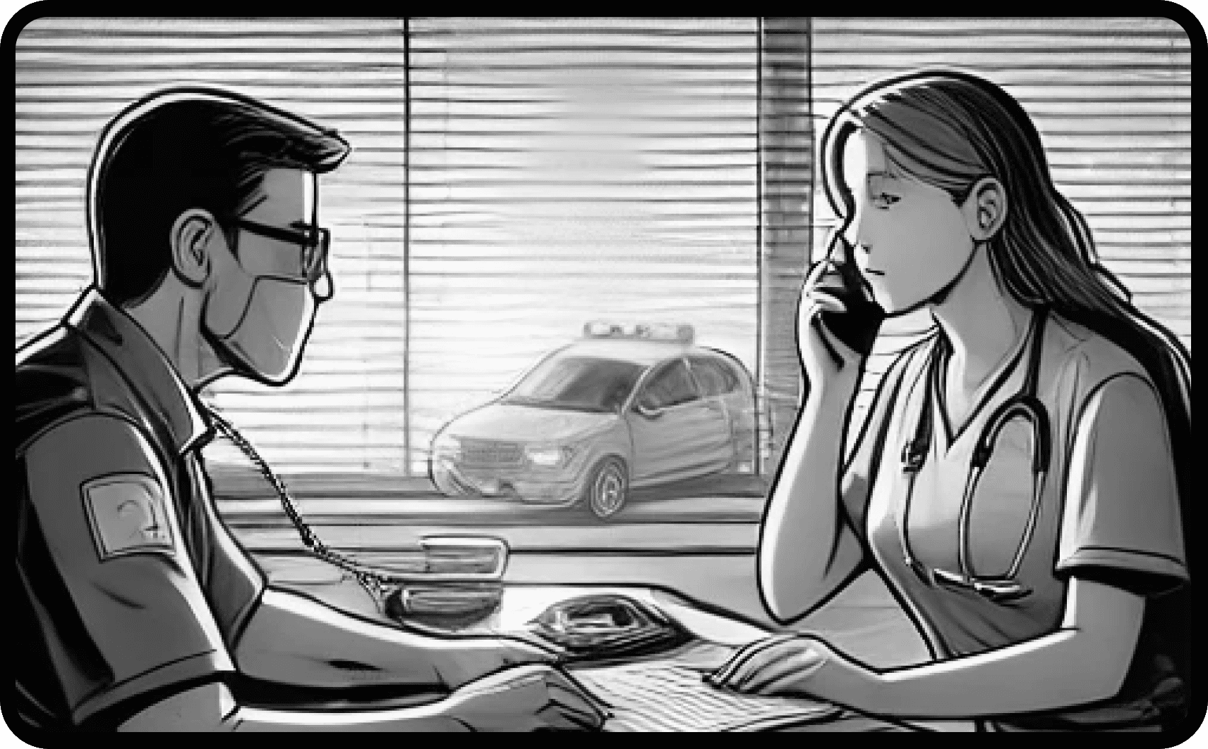
The ambulance driver receives a distress call from the control center with details of a critical patient requiring immediate medical transport.
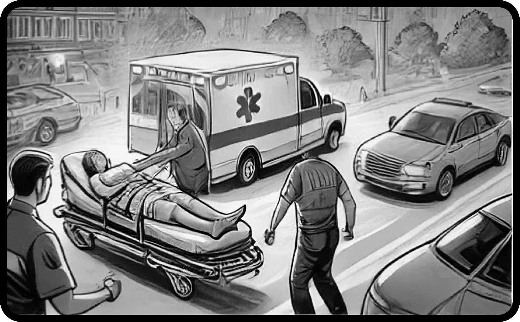
Upon arrival at the location, the paramedics carefully assist the patient onto a stretcher and secure them inside the ambulance, ensuring they are stabilized for transport.
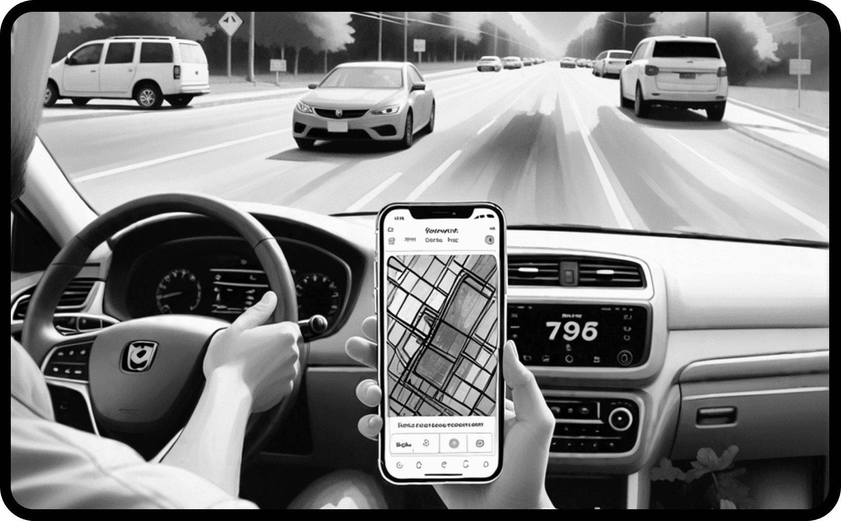
Before starting the journey, the driver activates the "Emergency Alert" feature on their smartphone or in-dash system to notify nearby vehicles of their critical route.
Drivers within a specific radius receive real-time alerts on their infotainment systems or navigation apps, highlighting the ambulance's route and urging them to give way.
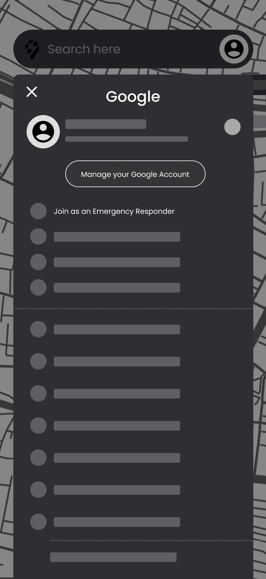
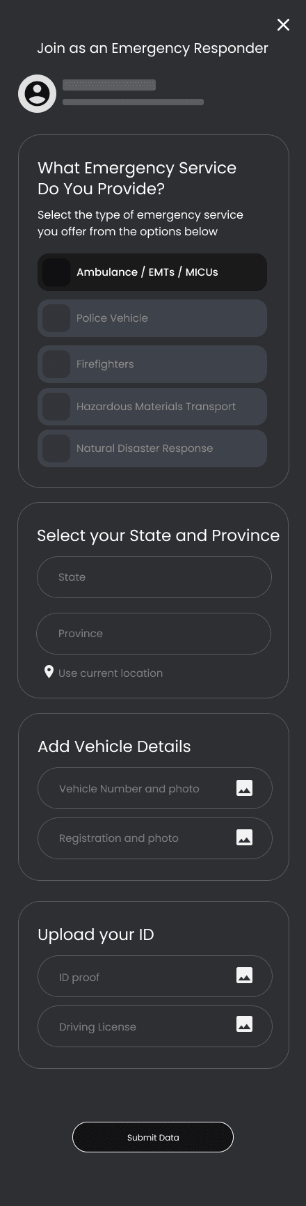
Registering as an Ambulance Driver / ER Team
After pinpointing a common frustration where users encounter difficulty obtaining tickets solely from the counter, which remains the sole accessible option for non-smart card holders, I'm addressing this concern by integrating QR scanning capabilities directly at the gate
Initial Registration: The first step is to register as an emergency service provider. This profile will give you access to system settings and further customization options.
Profile Configuration: From the profile, users can configure their status as an emergency service provider and add additional work profiles as needed.
1
2
Service Type and Authentication: The user is required to specify the type of service they are providing and complete the registration with necessary details to authenticate their identity. To improve efficiency, the system could integrate features like automated vehicle number verification through government databases or digital license validation via DigiLocker.
Confirmation and Onboarding: After completing the setup, a success message will appear. This is an ideal opportunity to educate the user on how the system functions, enhancing their understanding of the features available.
3
4

Setting Up for Emergency Dispatch
Based on our research findings, it's evident that a significant portion of users walk to the station daily(66%). To enhance this user journey, I'm introducing gamification elements aimed at making the walking experience more engaging and rewarding
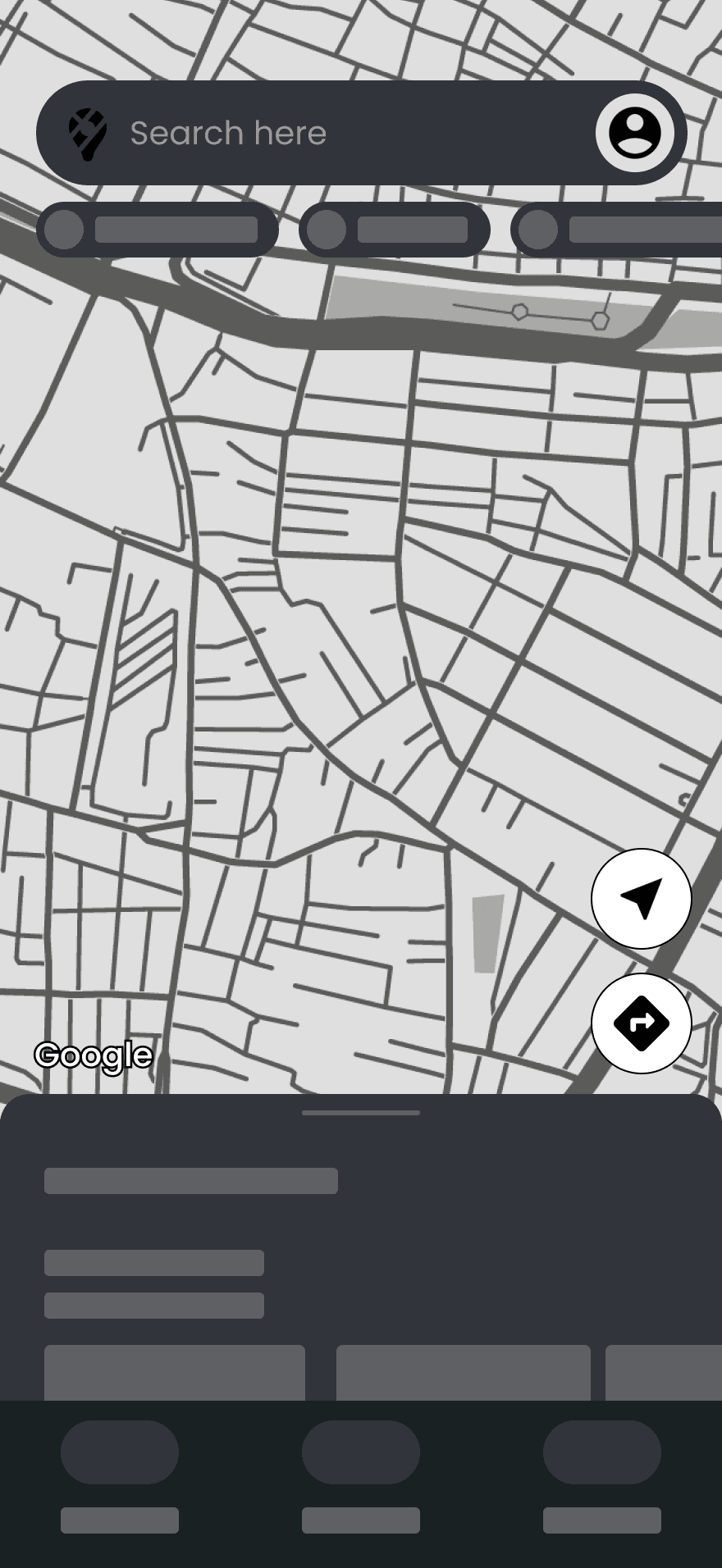
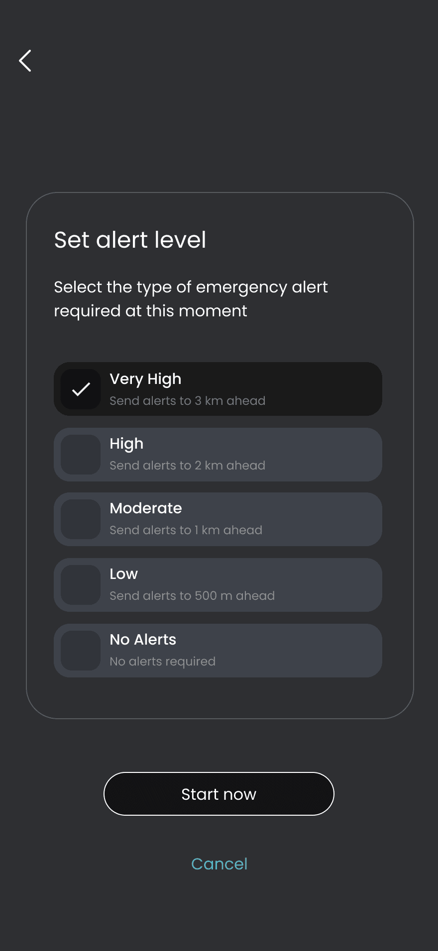
Switching to Emergency Mode: After registering the user profile, the user can toggle their profile to ‘Emergency Mode’ when needed. This action will display a new “Emergency Alert” Floating Action Button (FAB) on the viewport for easy access.
Alert Range and Speed Adjustment: The user can configure the alert level, which determines the range of the emergency alerts. This feature helps ambulance drivers send alerts to a broader radius, supporting them in maintaining optimal speed while navigating through traffic.
1
3
Destination List Based on Work Profile: Based on the user's selected work profile, the system will display a list of possible emergency destinations. For ambulance drivers, this will include locations relevant to their role.
Action Points and Real-time Adjustments: Once the emergency alert system is active, users are given specific action points to help them achieve their objectives. This includes options like adjusting the alert range, modifying the alert level, and an indicator that suggests alert adjustments based on real-time traffic conditions.
2
4

Drivers dash
I designed a tone checker that will always check the tone of the text and gives a hint about how the other person feels about it. This will helps to make a smooth conversations and convey message clearly and apps to understand how each person react and texts.
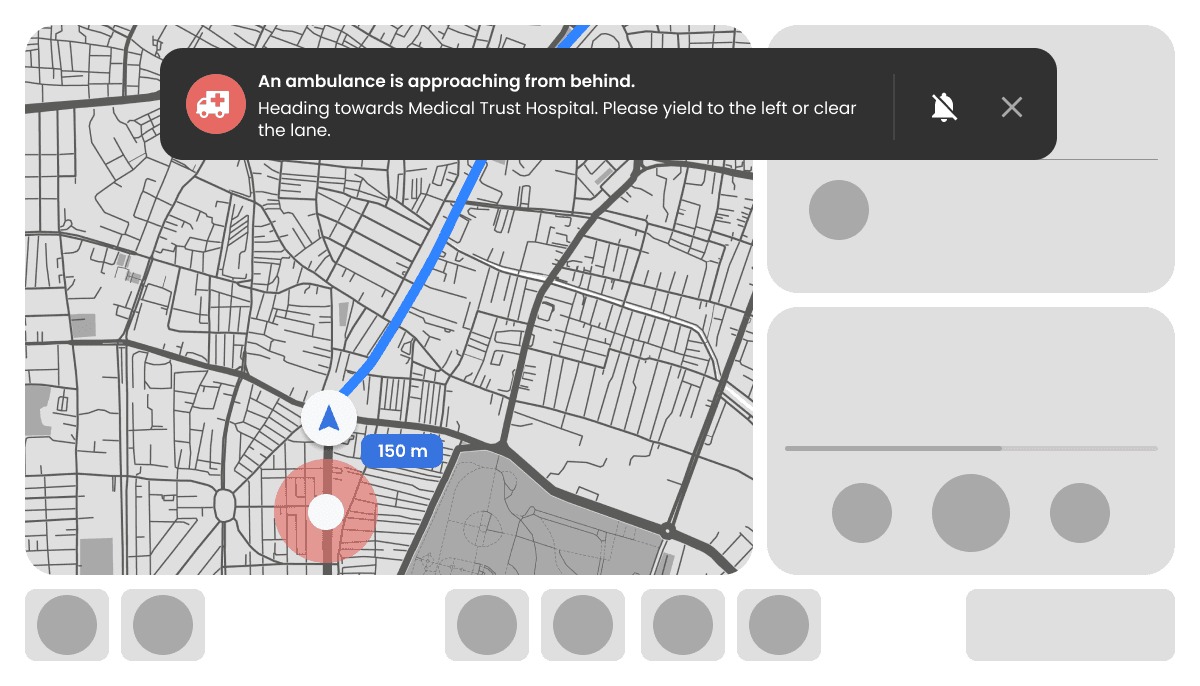
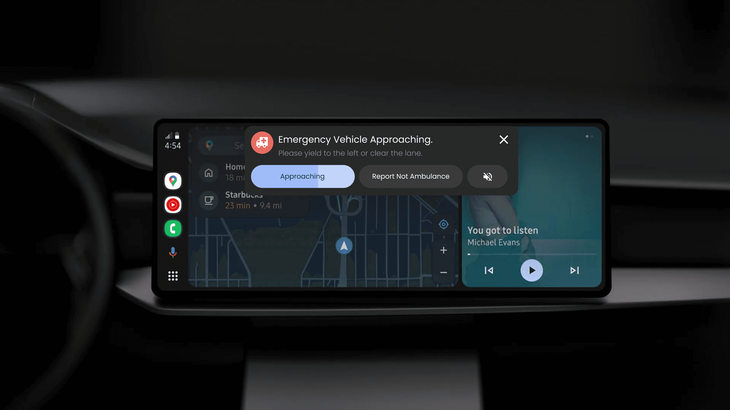
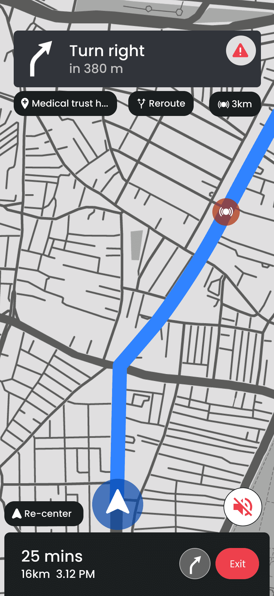
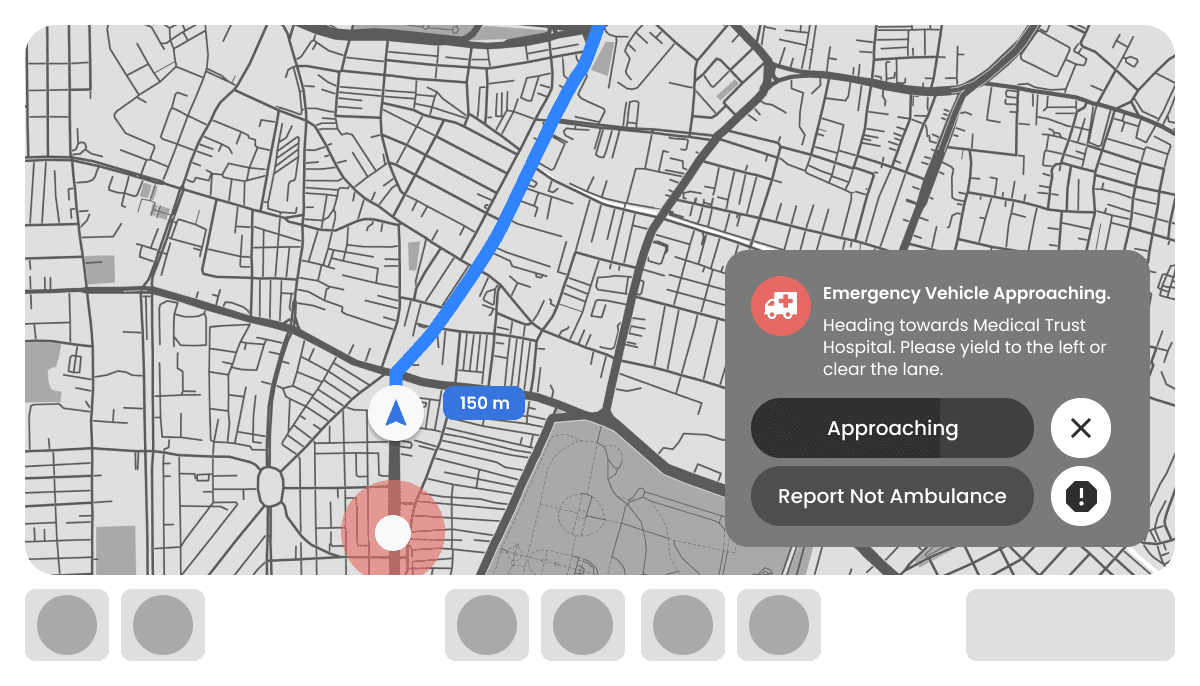
Alert Notifications for Other Drivers: On the infotainment system of other drivers, alert messages will appear based on the selected alert level and range, informing them of the approaching ambulance. The ambulance registration number is intentionally omitted to avoid unnecessary distractions.
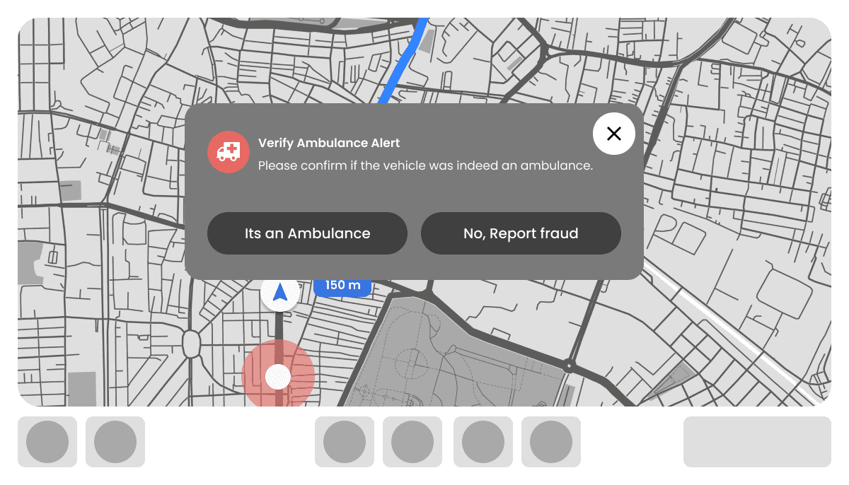
Approaching Ambulance Alerts: As the ambulance approaches, the system will trigger an alert to ensure other drivers are aware. To prevent misuse, users can report any situation where the alert appears to be false or not associated with an ambulance.
Post-Passage Reporting and Validation: After the ambulance has passed, users who feel the alert was incorrect can report it. If no action is taken after a certain period, the system will automatically prompt for validation to ensure the accuracy of the data.
1
2
3

This case study showcases how digital interventions—when rooted in empathy and designed with care—can solve real, life-threatening problems. By harnessing the scale and familiarity of Google Maps, we have a chance to make Indian roads safer, one alert at a time.
Thank You!
Now enjoy your drive!
Here is my next case study.
Designing an onboarding to reduce drop rate.
Read more
